![](/images/other/stat-length.png)
![Randonnée A pied Rothenburg ob der Tauber - Rothenburger W12 - Gebsattel - Photo](https://media.geolcdn.com/t/1900/400/d569b6e8-20ae-4c7f-9f17-9f200af7a901.jpeg&format=pjpeg&maxdim=2)
Rothenburger W12 - Gebsattel
SityTrail - itinéraires balisés pédestres
Tous les sentiers balisés d’Europe GUIDE+
![Longueur](/images/other/stat-length.png)
Longueur
8,2 km
![Altitude max](https://static1.geolcdn.com/siteimages/upload/files/1508320355ic_sort_altitude_max_24dp.png)
Altitude max
434 m
![Dénivelé positif](https://static1.geolcdn.com/siteimages/upload/files/1508320355ic_sort_den_pos_24dp.png)
Dénivelé positif
103 m
![Km-Effort](/images/other/stat-length.png)
Km-Effort
9,7 km
![Altitude min](https://static1.geolcdn.com/siteimages/upload/files/1508320355ic_sort_altitude_min_24dp.png)
Altitude min
368 m
![Dénivelé négatif](https://static1.geolcdn.com/siteimages/upload/files/1508320355ic_sort_den_neg_24dp.png)
Dénivelé négatif
134 m
![Boucle](https://static1.geolcdn.com/siteimages/upload/files/16400158638029165_repeat_loop_refresh_sync_direction_icon.png)
Boucle
Non
Balise
Date de création :
2022-02-11 12:51:00.55
Dernière modification :
2022-02-11 12:51:00.55
![A pied](https://static1.geolcdn.com/sitytour/trail-icons/100.png)
2h12
Difficulté : Facile
![Scannez ce code QR pour ouvrir la randonnée dans l'application SityTrail](https://capi.geolives.com/qq0zvz2zws4bq2lad0pu/sitytour/trails/3088163/qr.png?size=200)
Application GPS de randonnée GRATUITE
À propos
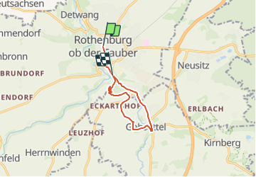
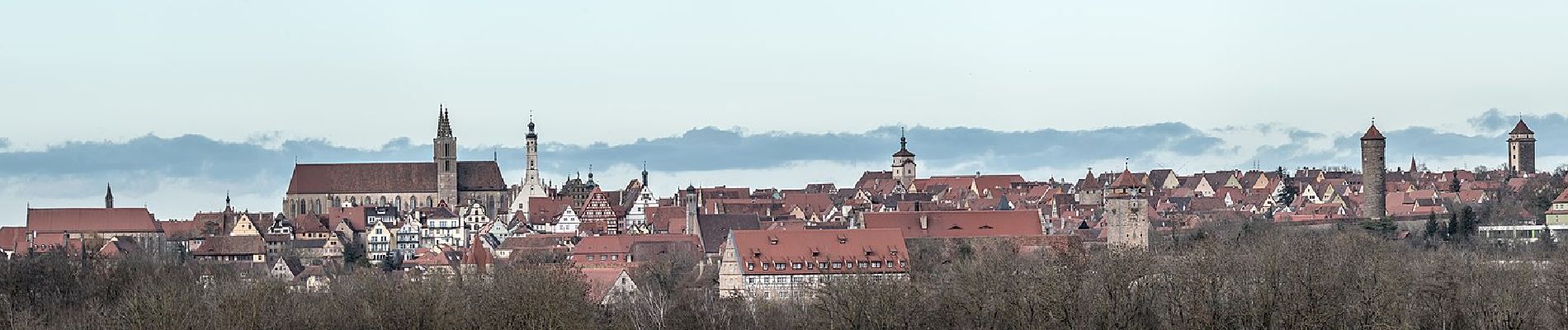
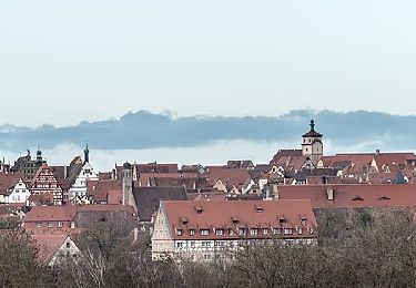
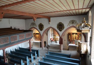
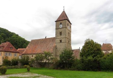
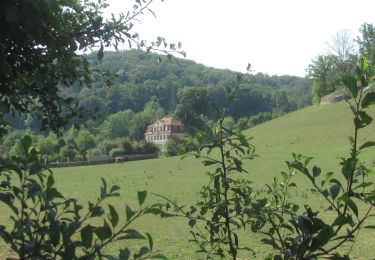
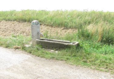
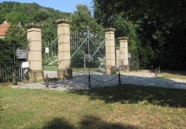
Randonnée A pied de 8,2 km à découvrir à Bavière, Ansbach (arrondissement), Rothenburg ob der Tauber. Cette randonnée est proposée par SityTrail - itinéraires balisés pédestres.
Description
Randonnée créée par Verkehrsverein Rothenburg ob der Tauber e.V..
Symbole: Weiße 12 auf rotem Schild
Localisation
Pays :
Allemagne
Région :
Bavière
Département/Province :
Ansbach (arrondissement)
Commune :
Rothenburg ob der Tauber
Localité :
Unknown
Départ:(Dec)
Départ:(UTM)
585594 ; 5470064 (32U) N.
Commentaires
Randonnées à proximité
![Randonnée A pied Rothenburg ob der Tauber - Rothenburger W4 - Natursteig - Photo](https://media.geolcdn.com/t/375/260/d569b6e8-20ae-4c7f-9f17-9f200af7a901.jpeg&format=jpg&maxdim=2)
![A pied A pied](https://static1.geolcdn.com/sitytour/trail-icons/100.png)
Rothenburger W4 - Natursteig
A pied
Facile
Rothenburg ob der Tauber,
Bavière,
Ansbach (arrondissement),
Allemagne
![](/images/other/stat-length.png)
6,8 km | 8,4 km-effort
1h 54min
![](https://static1.geolcdn.com/siteimages/upload/files/16400158638029165_repeat_loop_refresh_sync_direction_icon.png)
Non
![Randonnée A pied Rothenburg ob der Tauber - Rothenburger W3 - Kleiner Taubertalweg - Photo](https://media.geolcdn.com/t/375/260/2d219dd4-d118-4615-825c-f1e0ab382514.jpeg&format=jpg&maxdim=2)
![A pied A pied](https://static1.geolcdn.com/sitytour/trail-icons/100.png)
Rothenburger W3 - Kleiner Taubertalweg
A pied
Facile
Rothenburg ob der Tauber,
Bavière,
Ansbach (arrondissement),
Allemagne
![](/images/other/stat-length.png)
4 km | 5,6 km-effort
1h 16min
![](https://static1.geolcdn.com/siteimages/upload/files/16400158638029165_repeat_loop_refresh_sync_direction_icon.png)
Oui
![Randonnée A pied Rothenburg ob der Tauber - Rothenburger W1 - Detwanger Weg - Photo](https://media.geolcdn.com/t/375/260/3855134a-1211-4ce0-bb69-11a7db59eccd.jpeg&format=jpg&maxdim=2)
![A pied A pied](https://static1.geolcdn.com/sitytour/trail-icons/100.png)
Rothenburger W1 - Detwanger Weg
A pied
Facile
Rothenburg ob der Tauber,
Bavière,
Ansbach (arrondissement),
Allemagne
![](/images/other/stat-length.png)
3,5 km | 4,8 km-effort
1h 6min
![](https://static1.geolcdn.com/siteimages/upload/files/16400158638029165_repeat_loop_refresh_sync_direction_icon.png)
Oui
![Randonnée A pied Rothenburg ob der Tauber - Rothenburger W2 - Zu den Rothenburger Mühlen - Photo](https://media.geolcdn.com/t/375/260/fd08601b-fa2a-4d50-9433-292f77fe7f6e.jpeg&format=jpg&maxdim=2)
![A pied A pied](https://static1.geolcdn.com/sitytour/trail-icons/100.png)
Rothenburger W2 - Zu den Rothenburger Mühlen
A pied
Facile
Rothenburg ob der Tauber,
Bavière,
Ansbach (arrondissement),
Allemagne
![](/images/other/stat-length.png)
10,7 km | 13,3 km-effort
3h 1min
![](https://static1.geolcdn.com/siteimages/upload/files/16400158638029165_repeat_loop_refresh_sync_direction_icon.png)
Oui
![Randonnée A pied Rothenburg ob der Tauber - DE-NW blau - Photo](https://media.geolcdn.com/t/375/260/fd08601b-fa2a-4d50-9433-292f77fe7f6e.jpeg&format=jpg&maxdim=2)
![A pied A pied](https://static1.geolcdn.com/sitytour/trail-icons/100.png)
DE-NW blau
A pied
Facile
Rothenburg ob der Tauber,
Bavière,
Ansbach (arrondissement),
Allemagne
![](/images/other/stat-length.png)
3,2 km | 3,9 km-effort
53min
![](https://static1.geolcdn.com/siteimages/upload/files/16400158638029165_repeat_loop_refresh_sync_direction_icon.png)
Oui
![Randonnée A pied Rothenburg ob der Tauber - DE-NW rot - Photo](https://media.geolcdn.com/t/375/260/ad83b47e-3323-4ea1-8fe2-a79eaf813dd4.jpeg&format=jpg&maxdim=2)
![A pied A pied](https://static1.geolcdn.com/sitytour/trail-icons/100.png)
DE-NW rot
A pied
Facile
Rothenburg ob der Tauber,
Bavière,
Ansbach (arrondissement),
Allemagne
![](/images/other/stat-length.png)
7,7 km | 9,7 km-effort
2h 12min
![](https://static1.geolcdn.com/siteimages/upload/files/16400158638029165_repeat_loop_refresh_sync_direction_icon.png)
Oui
![Randonnée A pied Neusitz - Rothenburger W11 - Lug ins Land - Photo](https://media.geolcdn.com/t/375/260/1193c70e-1492-40c9-a8f0-1f45d7068679.jpeg&format=jpg&maxdim=2)
![A pied A pied](https://static1.geolcdn.com/sitytour/trail-icons/100.png)
Rothenburger W11 - Lug ins Land
A pied
Facile
Neusitz,
Bavière,
Ansbach (arrondissement),
Allemagne
![](/images/other/stat-length.png)
5,7 km | 6,8 km-effort
1h 32min
![](https://static1.geolcdn.com/siteimages/upload/files/16400158638029165_repeat_loop_refresh_sync_direction_icon.png)
Non
![Randonnée A pied Rothenburg ob der Tauber - Rothenburger W10 - Lindleinsee - Photo](https://media.geolcdn.com/t/375/260/1193c70e-1492-40c9-a8f0-1f45d7068679.jpeg&format=jpg&maxdim=2)
![A pied A pied](https://static1.geolcdn.com/sitytour/trail-icons/100.png)
Rothenburger W10 - Lindleinsee
A pied
Facile
Rothenburg ob der Tauber,
Bavière,
Ansbach (arrondissement),
Allemagne
![](/images/other/stat-length.png)
6,5 km | 7,4 km-effort
1h 40min
![](https://static1.geolcdn.com/siteimages/upload/files/16400158638029165_repeat_loop_refresh_sync_direction_icon.png)
Non
![Randonnée A pied Rothenburg ob der Tauber - Rothenburger W9 - Bettwar - Photo](https://media.geolcdn.com/t/375/260/a5789f1d-48b7-4b9b-bea2-01de53df7d3e.jpeg&format=jpg&maxdim=2)
![A pied A pied](https://static1.geolcdn.com/sitytour/trail-icons/100.png)
Rothenburger W9 - Bettwar
A pied
Facile
Rothenburg ob der Tauber,
Bavière,
Ansbach (arrondissement),
Allemagne
![](/images/other/stat-length.png)
6 km | 7,6 km-effort
1h 43min
![](https://static1.geolcdn.com/siteimages/upload/files/16400158638029165_repeat_loop_refresh_sync_direction_icon.png)
Non